Thursday, July 16, 2009

"Two little feet to get me 'cross the mountain
two little feet to carry me away into the woods
two little feet, big mountain and a
cloud comin down, cloud comin down, cloud comin down
I hear the voice of the ancient ones
chanting magic words from a different time
Well there is no time there is only this rain
there is no time, that's why I missed my plane"
Decided to refer back to my journal and a Greg Brown song for the third part of "Waste Not Want Not"
This is what I wrote (with some editing)
On day two of of waiting a day for a pickup, Jonathan and I decided to abandon the richness of our shelter for the less than certain chance of a floatplane pick up at sea level. We were motivated by travel plans (me to Glacier bay, Jonathan to Washington and Idaho) and by losing our only way to communicate with the outside world (Barth and Mary made it out in the morning). They left us food and a tent cached at Sisters lake, our job was to get there and hopefully meet a Ward Air plane at 5pm. There is a trail from Rust to Sisters lake, so this didn't sound all that bad and in fact it was quite doable. What is so bad about carrying alot of stuff downhill?
We left the tarp structure standing, the tent up and the less desirable food, garbage and traps up a tree. I somehow managed to fit all of my belongings into the large pack andstrapped the day pack to the outside of it. Jonathan carried the press and the few of his belongings that would fit in a large dry bag/pack, his camera bag and sleeping bag. Then there was the food bag with radio and water bottle; rather heavy, but it needed to come with us.
Paddling across the lake was a bit easier this time; serenaded by Jonathan and at the beginning a loon. The beginning of the trail wasn't terribly obvious,but we did find it. The trail itself was rather tricky, appearing and disappearing at rather inconvenient times. Alas I sent us off on a very wrong turn which added some distance and some totally unnecessary elevation gain. The trip down took much longer than the 1.5-2hours Barth thought it would. The wrong turn and the ridiculously heavy load didn't help. Happily we made it down in plenty of time, found the stashed gear and food, relaxed for a few minutes and then the Cessna arrived.
The float plane was wonderfully warm and dry after that sloppy wet walk.
The ceiling was just barely above 500 ft, we traveled along the outside coast of Khaz then down the outside of Kruzof as Salisbury was full of clouds. Great aerial tour of sandy beaches and survey of trollers on the eve of opening day. We finally made it across Kruzof just north of Mt Edgecumbe.
Mary met us at the Forest Service dock and saw Barth cheering from the fuel dock. It was nice to make it back in time for a cheeseburger, shower, deal with the plant press, laundry and repack for Glacier bay.
Left the house at 4:45, flew to Juneau, had breakfast at the Silverbow, did some grocery shopping and left Juneau for Glacier bay at 11am on board the Iyoukeen.

It turned out to be 10 days of sun
Wednesday, July 15, 2009


Must be time to get up to the Harbor Gavan trail. Ian returned home this morning with these flowers tucked in his pack strap.

Tuesday, July 14, 2009


" Waste not, Want not" part II

There were two reasons to go to Rust Lake, one was simply logistics, Mary and Barth were planning a trip there to look at options for restoring the lake and the other was the band of marble/limestone that occured nearby.

The second morning we set up off up the valley toward one of the carbonate outcrops. Fortunately it was a relatively obvious path, as I had managed to leave the aerial photos and topo behind in my hurry.

We crossed the creek at the second or third gravel bar, found several (14) poppies (not blooming) and further off towards the cut bank, several bones of a long dead bear. Long enough time had passed that there was moss growing on the bones (not fruiting though). Didn't see any knawing on the bones which seemed a bit odd. Thought that a large source of nutrients would have been pretty attractive.

Carried on up the river; through open meadows, another gravel bar with poppies, then dove into the scrubby forest. Not too far along, I tripped over something (very unusual) and saw about 4ft in front of me a very small, spotted fawn tucked under a blueberry bush. . It held very still for a time (I'm not here,really), then scampered off. Felt rather badly about disturbing it, I'm hoping that mom found it again.
Not too much further on, found more of the green appressed Nephroma on another Mountain hemlock and a smallish Sorbus sitchensis.
As we climbed (pretty gentle incline), the vegetation shifted from moderately productive mountain hemlock to mixed conifer interspersed with more typical muskeg/bog areas. The feeling was still of upper elevations; there was plenty of Cassiope mertensiana, Elliotia, and Nephrophyllidium crista-galli.
Like I hinted at in the last post, I had forgotten my aerial photos (I studied them, but how much was I going to remember?) at home and forgot that there was a small lake below the limestone area. Fortunately, we ended up on the open muskeg side of the lake (still had ice) and it was pretty easy getting around. We had a bit of a sun break here (may have been the only one of the day). Once around the lake, we went a bit further along the pass to Patterson Bay, before heading up the much steeper slope to get to the open rock. The rock on the west side of the pass was not carbonate.

Found Polystichum lonchitis and Asplenium trichomanes -ramosum at the base of the mountain. I haven't really decided what to call the place; is it a moutain? it goes above tree line, it seems more like a nunatak, but I'm sure that term should only be used to describe mountains above the icefields. Might stick with nunatak for now.
Going up the slope was interesting (code for slightly scary); I hadn't any prior experience with karst topography, but had read enough to be aware of sinkholes, but not how sharp some of the rock formations were. There was smooth rock, areas that were deeply vertically incised into channels by water (solifluction rills? Grikes?), sinkholes, column-like areas within sinkholes and really sharp mini mountains. Gloves would have been handy as would tougher rain pants. I managed to rip a few holes in my raingear clinging to the rock (I missed the sticky rock of Red Bluff).

From a brief conversation with Deirdre, it seems that the difference in weathering might be caused by differences in mineralization or metamorphism?

The P. lonchitis was abundant; and some of it was as large as sword ferns I'd seen down south. It was interesting that this fern was growing from the lower slopes to the top of the nunatak (in crevices only on top).

There was still alot of snow in large patches, most of which we didn't walk on; it was kind of difficult to tell if there was ground below the snow or if it was a "Snow field of death".

There were alot of interesting plants on the hike, including Anemone parvifolia, Saxifraga oppositfolia, Erigeron humilis, Silene acaulis and a few species of willows (including reticulata).
On top found Geum rossii on a few outcrops; abundant Pedicularis oederi and Oxytropis campestris (or some segregate). There were two species that I hadn't seen around here; Lloydia serotina ( a rather small lily-looking flower) and Thalictricum alpinum (not blooming). Both were growing in very shallow soil over rock. I was anxious to find the latter, earlier in the hike I was conjuring it out of weird looking columbine foliage. This species of Thalictrum is substantially smaller than the columbines, but the foliage pattern is pretty similar.

There were patches of meadow-like alpine plants; Arnia, Geranium, lupine, Columbine and Pink Paintbrush.

The going got much more certain on the top, it seemed that there was a mixture of rock types on the top. Despite the cloudy and frequently rainy weather, the view was pretty spectacular.
Saw a Rock Ptarmigan (?) still in winter plummage, RC thought that the males remain in winter plummage longer than females and kind of act as a distraction for predators.

I was rather relieved when we found an easier way down than the way we came up. I wasn't looking forward to clinging to the sharp rock while finding footing. As it was, I was grateful to accept a hand a couple of times over gaping holes.
"waste not, want not" (Part I)

Rust lake experience turned out to have rather convoluted logistics, marginal weather, but very interesting natural history.

Things started out a bit crazy; Richard and I got to the float dock a tiny bit late and Mary Emerick looking a bit frantic with a phone in her hand. It turned out that RC's partner's father had passed away and he couldn't go on the trip. This left me a bit frantic, it was the second trip in a week that would have been cancelled for some reason or other and I was beginning to feel like I wouldn't get anything done on the Wilderness survey project. After some frantic phone calls looking for a last minute substitute (on another phone, I couldn't find mine), I gave up and went to yoga and ate some pizza. At about 2pm, I found my phone and a field partner, Jonathan Goff. Called dispatch, arranged a flight and off we went. I should have taken the time to get a sat phone and perhaps checked my backpack for the aerial photos and topo map...

We did have half the food, some gear and a boat with oars (no life jackets, no outboard) and landed at the lake without much of an issue. The only question was; when were Barth and Mary going to join us?

The rest of the day, we set up camp; fortunately Jonathan found a large tarp in the trees (not since grad school had I felt so materially wealthy) and two 8ft (?) treated 2x4's and two 2x2's and we built a pretty skookum shelter. My earlier attempts at building a shelter from alder was fairly pathetic, but it kept me entertained.


Rust lake was dammed in 19?? as a reservoir for a power supply for a Sister's lake mining operation. They put a valve that seems to have malfunctioned at some point and Rust lake has a lower water level than it had in the past; there is a noticable band of rock or gravel (bathtub ring) around the lake.

The beach near the campsite had a cover of Racomitrioideae and Stereocaulon (brown apothecia) with scattered small spruce, mountain hemlock and sitka alder. There were deer and goose tracks along the shoreline below camp and a somewhat pesky pair of nesting mew gulls on a large rock in the lake near shore. They didn't seem to appreciate dish washing.

The next morning we decided to try to paddle across the lake to see if Barth and Mary were in sight. Paddling proved rather difficult in the wind, we made it about half way across the lake and decided to explore the south shore instead. Found a population of what seems to be Viola langsdorfii with an impressive amount of variation in size and color. I collected a range of the plants and plan on sending them off for a second opinion.

Adjacent to the lake was some shallow to bedrock muskegy like vegetation and outcrops. Found a Primula cunefolia, Dodecatheon jeffreyi, Elliotia and Pinquincula. Kind of an odd mix for 800ft.

On the far side of the outcrops and muskeg was a tall sedge meadow (we would see alot of tall sedge meadow in the area). Blooming Petasites and Caltha leptosepala, young Veratrum, Frittilaria and Athryrium made up the bulk of the non-graminoids. It turned out that most of the bear sign we saw was in this area. We started around the lake through the moutain hemlock/spruce forest thinking that it might be alot better to walk around than paddle, but decided that leaving the boat would cause alot more hassles than retrieving it. The highlight of the forest was finding large patches of Nephroma on the trunks of a few Mountain hemlocks. It was green; which reminded me of N. arcticum, but the habitat was wrong. I still haven't quite decided about the identity of this lichen. Also noted many Streptopus streptopoides blooming.
Collected blooming Sibbaldia procumbens from the lake shore.


Paddling back to our side of the lake was a real chore, the head wind was not merciful. We couldn't stop paddling or we traveled backwards, much vocalization and swithing of sides was required to make the trip.


Made our first foray up the creek to look at the gravel bar vegetation (poppies, cerastium, oxytropis, dandelions) and set out the snap traps in the meadow in the afternoon in hopes of catching a vole.

It turns out, I'm not much of a trapper, not surprising. Probably should have read up a bit on the habits of voles or brought more traps ( had 11). The next day we found a more heavily used (at least that we could see) vole site on the first gravel bar. We did catch and lose something in that area, at least the trap was knawed).


The lower reaches of the creek had pretty interesting cut banks which gave an indication of the role geomorphology had in determining the vegetation type. We could see a band of peat over what looked like till and in an adjacent rill, we found a nice outcrop of fine silty sediments. Not clay, at least it didn't roll into much of a stable worm.

The vegetation in the the valley along the river was fens (tall sedge) and small patches of Spruce-Mountain hemlock/ blueberry forest . The dominance of tall fens seems to be due to the layer of basal till and the preponderance of small minerotrophic water ways running through the area. It was rather spring-like up there, so I couldn't identify all of the sedges etc, but did see Carex lenticularis, I suspect that there are probably a few more species eg. C. aquatilis. Dodecatheon jeffreyi and Rubus stellatus were in bloom.


I was oddly enthralled with the slumping peat banks along the river. Right across from this bank we found our first and only poppy in bloom. The rest of the plants were on the opposite shore and not quite blooming.


Went to Blue Lake around noon to spend the night to be in position for a breeding bird survey on the 19th of June. After dropping the overnight gear at the gravel bar near the lichen rich alder/nettle avalanche track, we proceeded up the creek with the intention of at least getting around the barrier falls. We went a bit further.
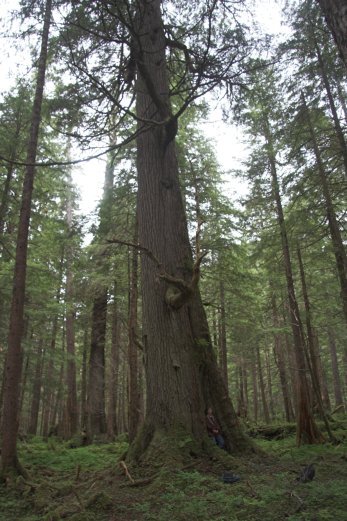
Did stop to check on the lone poppy in the gravel bar and to "measure" the exceptionally large cedar along the trail. My reach is roughly 5ft 3", it seems like the tree must have a diameter of slightly less than 5ft.

The valley beyond was narrow U-shaped one with an interesting mixture (or maybe tangle) of different vegetation; alder thickets, youngish mature forest, boulder piles with subalpine like shrubs and a lovely patch of nettles. Seems like the driving force in succession in this valley is probably avalanches and mass wasting. Wind may have some role, but it seems secondary.

There was one slide not too far past the falls that seemed like it happened this last winter or spring, found some bones and a nice bit of hide of a mountain goat in the snow. Some of the hair is now in my freezer, hopefully, I'll get this spun this winter.

We made our way up the valley using the rather large remaining patches of snow allowed for easier going. Things were pretty springlike (plant wise) beyond the falls. Ranunculus coolyeae was blooming and many of the plants that would have made the walk more challenging were short or buried in snow. Did find an interesting Agrocybe in the alders.

Finally reached a point in the evening that it was time to turn back; it would be well worth a return. The valley felt like we were at the core of Baranof; steep valley walls, rugged topography and a raw kind of feeling. We could see muskegs much further up the valley and Mountain goats not really all that far above us.

Before we headed back I collected a bag or two of young nettles and fiddleheads. Many of the young nettles were purple.